A Manx Return
Cycle touring on the Isle of Man
May 2017
Helen and I enjoyed a splendid cycling tour on the Isle of Man just 4 years ago, in 2013, but there were, we felt, lessons to be learned from that experience. In particular we had, on reflection, decided that 3 days was really just too short a time to get the full benefit of what the island has to offer, and, secondly, that riding an anticlockwise route round the island had not worked well as we had battled a fierce headwind on the long day we rode from Ramsey to Peel, and perhaps more pertinently had finished that day with a gruelling climb over Barrule with tiring legs and declining weather. Despite those shortcomings we had resolved to return and put right those wrongs and enjoy the experience even more.
The Plan
Ferry sailings from Liverpool to Douglas have a profound impact on the time that can be spent riding. Our 3 day trip back in 2013 was, in reality, one full day and two half days which, for a route of 150km or so, seemed fine on paper but allowed little time for dallying, savouring moments and sipping at the cup of Isle of Man culture occasionally. So the first change was to lengthen our trip to 4 days thereby allowing us an extra full day on the bikes which in turn shortened the distances to be covered each day. The second and equally obvious alteration was to follow a clockwise direction round the island which (hopefully) would mean more time with prevailing weather on our backs, not in our faces.
Our previous visit had been towards the end of June, a couple of weeks after the TT races which are such a major part of the Isle of Man calendar every year. This time we decided to visit a little earlier which meant squeezing in ahead of the TT fortnight, and we were surprised to find that accommodation was more difficult, even though we were planning to be there a full 2 weeks before the event. Nevertheless we managed to find ourselves places to stay for each of the 3 nights we planned to be on the island and breathed a little more easily. Getting there is easy, the Isle of Man ferry service from Liverpool is so good. There is something ultimately incredibly satisfying about the thought of rolling out of the front door, climbing on our bikes, heading for Chester station for a train to Liverpool where it was but a short hop and a skip to the ferry terminal. No need for the complications of using a car, and also considerably cheaper!
After studying the map and planning a slightly more inquisitive route that took in some sightseeing along the way we came up with three overnights at Castletown, Peel and Ramsey respectively. Each of these towns merits attention in their own right and it meant that the distances each day simply felt about right. Nothing too long, nor indeed too short. And, more importantly, time each day for the odd cake/coffee/beer stop along the way.
So, that was it really. As with previous touring trips our philosophy of travelling light has not changed, which potentially left us hostage to the weather but made the riding so much easier. The bikes were fettled, the bags packed and set in place, the Garmins charged and our credit card was to hand. Time to go....
Day 1: Chester to Castletown (28km)
On paper a very short day but complicated with a number of transport modes involved. We rolled out from our house in Hoole and headed for Chester station in time to catch the train to Liverpool. Helen was riding her trusty Trek Lexa, a veteran of several such tours and
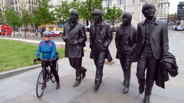
I was aboard my Enigma Etape titanium steed, made for trips like this. The journey to the station is short both in terms of time and distance and, after carrying our bikes (and bags) up the station stairs and over to platform 7b we stowed them away in the bike storage spaces on the train and settled down to enjoy the 40 minute train journey. Before we knew it we were carting our bikes back up to street level in downtown central Liverpool and heading the few hundred meters down to the Pier Head jetty to board the Isle of Man ferry, Helen taking time out to pose for a quick photo opportunity with the Beatles in front of the imposing Liver Building.
The Isle of Man Steam Packet Company has a bit of a monopoly on the ferry crossings to Douglas but, certainly in the case of cyclists, doesn't seem to take advantage. In no time we were on board, the bikes secured on the car deck, and we found ourselves up on deck watching as the ferry cast off and drifted away from the dockside. Douglas, here we come! We spent the first part up on deck watching as Liverpool docks slipped past before heading out into the Irish Sea which seems awash with hundreds, if not thousands, of wind turbines off the coast at Crosby, part of the growing Burbo Bank offshore wind farm. It must require some concentration to negotiate a safe passage through this seafaring obstacle course but we made it and soon were on the open waves. The crossing is quick and some 2 hours later we were rolling into Douglas harbour, clouds swirling on the high fells in the central part of the island. Not perhaps the warm sunshine we hoped for but at least it was dry.
Our first priority was some lunch to set us up for the rest of the day. Nothing fancy, a pub or café would suffice. We rolled along the seafront and eventually came across an seafront arcade with a suitable looking establishment which seemed to fit the bill. Davisons Manx Dairy Ice Cream Parlour ticked the boxes, had seats aplenty outside and we were soon ordering and taking in the sea views which were a murky shade of grey. The Douglas seafront has a very Victorian look to it, rows of imposing hotel fronts along a crescent-shaped boulevard. A sunken gardens adds to the imperialist feel that exudes as a result of the town's growth into a thriving holiday destination in the late 1800s as the travel links to Liverpool were established. As we rode along the prom, having finished our lunch, we watched as our ferry boat sailed out of harbour heading into the murky Irish Sea and back to Liverpool. Our road led south. And up.
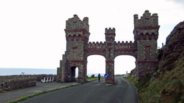
At the southern end of Douglas' esplanade and beyond the ferry terminal a small road heads steeply up to Douglas Head, the cliffs which overlook the bay. This in turn leads onto Marine Drive, a spectacular road which winds southwest along the cliffs with views to match, even on a grey afternoon. Behind the town the geography climbed up to the high moors with Snae Fell prominent on the skyline brooding under the heavy cloud. The bonus for us was that this road is closed to cars and other vehicles beyond a certain point, a cyclist's dream. We negotiated our bikes through a gateway and had the road to ourselves for the next couple of miles, bimbling along savouring this heavenly state of affairs. Even better, after a gentle climb to a high point the road then gradually descends before rejoining the real world and a return to normality. Of course, at this point we now had to climb again to join the Old Castletown road, a bit of a drag but not too unpleasant.
The thing about the Isle of Man roads is that they have a habit of thoring the unexpected at you. On the map the route to Castletown seems straightforward but occasionally a deep sided valley has to be negotiated, rather more frequently than certainly Helen appreciated. This slowed our progress a bit but we had all afternoon and our spirits were boosted by the brightening skies. As we approached Castletown the sun was threatening to put in an appearance and we rolled into the ancient Manx capital in high spirits. Our accommdation was an Airbnb establishment (more on that later) and we parked our bikes, freshened up and headed out into the centre of town, a stone's throw away, in search of refreshments.
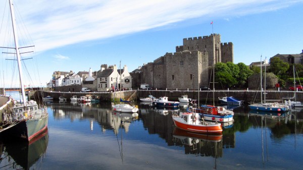
Castletown is not big but does have some fascinating historical buildings, not least down to the fact that until 1869 it was the island's capital and home to the Tynwald, the Manx parliament. It has a medieval fortress too (Castle Rushen), an old harbour and some narrow streets to add an ambience to the place. By now it was a pleasant afternoon and we found ourselves in the marketplace outside a pub, the George Hotel. Well, it would have been rude not to, so we procured ourselves a cheeky beer and sat on the benches outside soaking up the atmosphere. They even had the flags out for us!
After this enjoyable moment we went for a bit of an explore, camera to hand, and spent the next hour diving down alleyways, turning unexpected corners, enjoying the history the town has to offer and generally soaking up what Castletown has to offer the curious visitor. It was a thoroughly relaxing way to end the first day of our Isle of Man Cycle Tour 2017.
Day 2: Castletown to Peel (44km)
Call me a pedant but for me the concept of Airbnb is that accommodation provides both bed AND breakfast, hence the name. Sadly for us, here on the Isle of Man this is not permitted – there are legal issues as to what accommodation providers are able to offer to guests and for many Airbnb establishments breakfast is not on the list. This proved to be an unexpected twist to our hoilday and meant that we now had the added complication of sourcing some breakfast to start our day, not as easy as we might have hoped. Having packed our bags, fitted them back on to our bikes and said our goodbyes to our hostess we rolled into town in the morning drizzle in search of something suitable to kick start our day on the bikes. This came in the form of Coffee Republic, a utilitarian coffee establishment reminiscent of Costas, and serving tasty muffins and surprisingly good coffee. It ticked the box and we felt better for it, ready to face the day ahead, even in the rain.
Today was not a day to rush, the distances involved weren't great although we did have a mountain to get over later on. As such we felt relaxed and happy to take side roads and explore. From Ramsey we headed out to the main A5 but almost immediately took a small side road following NCN route 3 which headed back to the rocky coastline overlooking Bay ny Carrickey to Port St Mary. We stopped awhile to enjoy the view, improved now the rain had more or less stopped.
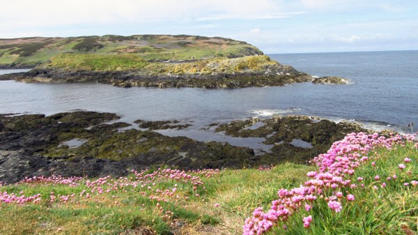
Still following NCN3 we passed Port St Mary and headed west on the Road to the Sound, an appropriate name for the road which leads to Calf Sound which is the island's south-western tip and looks out to the Calf of Man, a bird sanctuary since the 1950s and home to a breeding colony of Manx Shearwater. The island is now owned by the Manx Heritage Trust. A small cul de sac road (the A31!) heads down a viewpoint above the sound with the island tantalisingly close across the water. We parked the bikes and explored the footpaths here, enjoying the views and finding some history too (there are no less than two monuments nearby). More importantly to any cyclist was the Sound Visitor Centre and associated café. Time for coffee and cake! We sat on the terrace and gazed at the grey seals basking and playing on the rocks on the island just across the water.
The presence of an arrow on the OS map indicated what we already knew. Being a cul-de-sac our route now took us back up the steep hill away from the Sound Café and on to the next leg of our journey, heading for Port Erin. Bheind us the receding Calf of Man could now be
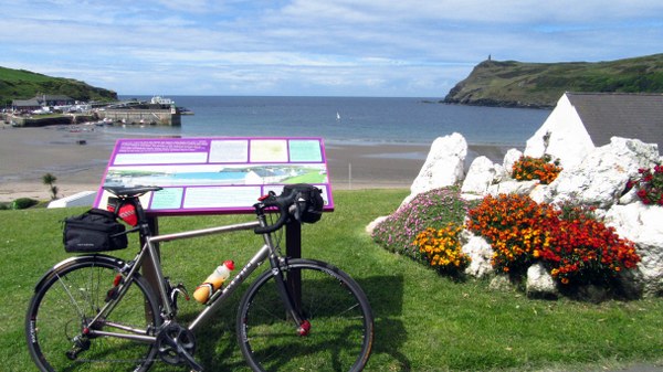
seen in its entirety, as we rode into the village of Cregneash and rejoined NCN3 on a tiny moorland road which heads north over Mull Hill and reveals dramatic views over Port Erin which suddenly lay far below us. In the distance, still somewhat brooding under the cloud, were the mountains of South Barrule and Snae Fell, a taste of what lay in store later! This was cycle touring par excellence, a delightful quiet road with vistas to savour and then, equally dramatically, a steep descent to Port Erin Bay. Port Erin is another seaside town with a regency air about it, the line of hotels along the bay reminiscent of a different time. It is pretty but with an air of decay.
We stopped to take in the views of the bay and the headlands from the seafront but did not stay long, we had a big hill to climb. Our route from Port Erin took us back east riding alongside the lovely Isle of Man Steam Railway, still on NCN3 and headed for Colby and Ballabeg. As luck would have it a train came chuffing along bound for Port Erin and we stopped to watch as it chuntered past. At Ballabeg we finally left NCN3 behind as we turned north which also meant a change in gradient as we now started the long climb into the hills and over to Peel. The climbing was steady rather than dramatic but looking behind us we could see the coast falling away. Also, as we climbed, we hardly noticed it but the clouds were peeling away and the sun was trying to break through. It was turning into a nice day – very welcome after the early rain.
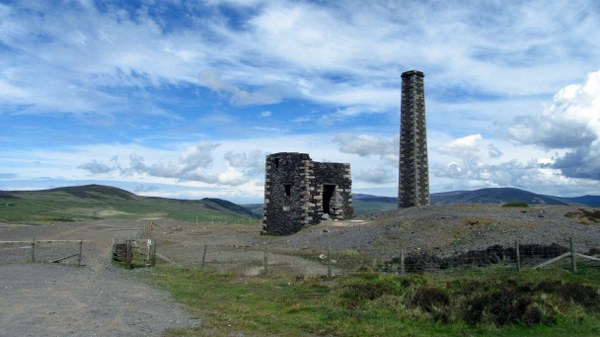
Eventually we topped out around the 200m contour at a T-junction below the summit dome of South Barrule, and now headed east round the hillside to meet up with the main A3 trunk road between Castletown and Peel and which took us over the shoulder of South Barrule and past the Forest Park, a renowned cycle trails venue. Turning left onto the A36 we now topped out at our high point for the day (some 300m) with splendid and wide-reaching views north to the central hills of the island and also over Foxdale now below us. It was desolate country and laid waste somewhat by the vestiges of a now defunct lead ore mining industry. As we started descending we came past the still intact 19th century chimney of the Cross Vein Mine (which also went under the intriguing name of Snuff the Wind). We stopped to explore and get a taste of times long gone.
The hard part of the day was now behind us and now came a long downhill section into Foxdale on a small road, part of NCN4. Bluebells lined the roadside and the sun was now properly out. A feature of much of the last couple of hours had been the absence of any traffic
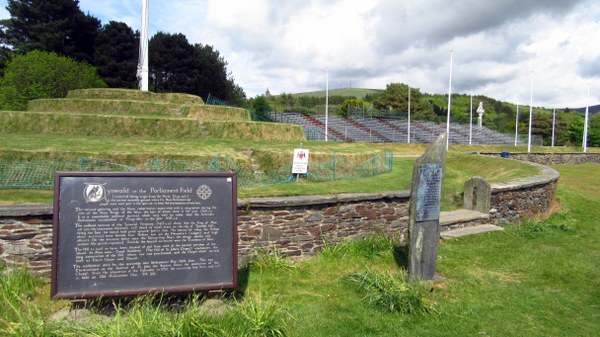
of note. The odd car here and there but generally the roads were wonderfully quiet. The Isle of Man has a rich cycling heritage and it is easy to see why. As we rode into St Johns, crossing the renowned TT Course which uses many of the island's main roads, we now felt in some need of food and refreshment, having been on the go for over 5 hours since breakfast. As luck would have it we spied a pub opposite the Parliament Field, the ancient gathering ground where the Manx Tynwald would meet and dating back to early in the 1400s. Strangely enough he pub was named the Tynwald Hill Inn, perhaps not too much imagination, but welcome enough. A cheeky beer and some fine scran set us up for the rest of the day's journey, all 6 or 7 kilometers of it, for we were now almost in Peel.
Suitably refreshed and after “doing” the Tynwald Hill visitor experience (we climbed the hill) it was an easy ride down into Peel, another ancient capital (it was the Manx capital until 1344) and the third largest town on the island and the main fishing port. Suddenyl all was hustle and bustle, this is a thriving town and was the first time we had seen large numbers of cars and people all day. Peel also has a sweeping seafront round Peel Bay and a headland on which the ruins of Peel Castle proudly sit. We decided it was time for an ice-cream, especially since we couldn't check into our Airbnb accommodation until 4 o'clock, so we sat on the seafront and admired the Manx seaside view chomping on our ice cream cones.
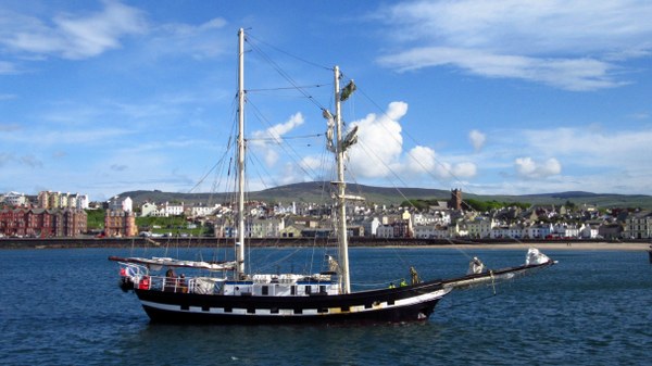
Once checked in and it still being relatively early in the afternoon we had plenty of time to explore and see the town sights. Like Castletown, Peel has some history and is awash with little backstreets and colourful buildings, as well as the harbour and castle which are always good places to explore. We watched from the harbour wall as a sailing vessel made heavy weather of coming in to port and docking, but it made a great picture against the regency seafront buildings.
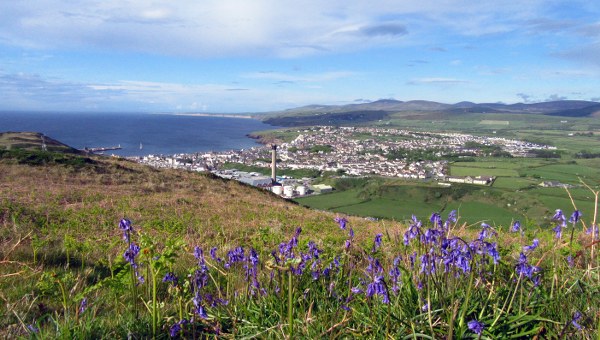
A footpath winds its way round the castle perimeter above the cliffs, and we wandered our way through sea thrift and daisies which had found a foothold in the masonry of the now ruined castle walls. To the south of the harbour a path leads away from the town and up Corrin's Hill, a modest top, only some 150m in height. Well, it would have been rude not to, on such a fine afternoon. So we did. The views back over the castle, harbour town and hills beyond were spectacular as we climbed. The camera was busy (no surprises there) and there were plenty of opportunities to stop and enjoy the scenery. At the top is an intriguing folly, Corrin's Tower, which dates back to 1806 along with a small graveyard where Thomas Corrin's family are buried. Views north and south along the spectacular coastline are extensive and we spent a good while simply enjoying the sense of the place before heading back down into town to find somewhere for supper. And what could be better than a pub supper with a cheeky beer to wash it down?
Day 3: Peel to Ramsey (68km)
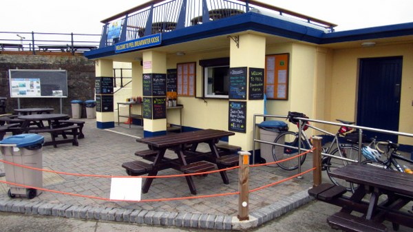
Our longest day, but still comfortably easier than on our previous visit to the island back in 2013. And this time the weather was with us, no nagging headwind to contend with. Sadly yesterday's sunshine had disappeared and we awoke to grey day with a very overcast feel to it. And it was cold, not what we had hoped for at all. Yet again we were faced with the breakfast conundrum as our Airbnb hostess was unable to feed us. I do feel this is something we should have perhaps been made aware of when booking, but we took it as an opportunity. On a grey morning Peel does not have quite the same feel as it had the previous evening in the sunshine and we struggled to find anywhere which might tick the breakfast box, eventually ending up on the harbour wall next to the castle where a snack bar, the Peel Breakwater Kiosk, was doing breakfast butties and piping hot brews which we were able to enjoy in the light drizzle overlooking the sea and watching a grey seal play in the rolling waves below us.
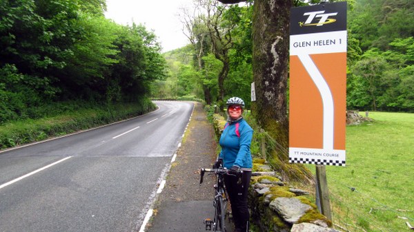
Feeling ready for the day we kickstarted the Garmins and rolled out alongside the inner harbour past the geese which had chosen the centre of the road to sit awhile and challenged anyone who might want them to move. Our route today had us retracing our steps to St Johns before turning north and heading out along the TT course which runs alongside the River Neb in tree lined pastural countryside, all the while being reminded of the heritage as TT course signs told us of upcoming hazards. We came to the Glen Helen bend which, of course, demanded a photograph to record our passage. In a couple of weeks this road would be closed to all and sundry as the TT bikes tore their way along the straights and through the corners but today it was quiet with only the occasional car to disturb our passage.
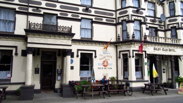
We followed the TT course on the A3 for some distance, all the way through Kirk Michael, bizarrely linked with a village in Nepal, and on to Sulby where the infamous Sulby Straight allows eye-watering speeds as the TT bikes would rip past the old Sulby Glen Hotel. We chose instead to stop and savour the place, it seemed apposite as we now had 25km in the bag and a couple of hours had passed since breakfast. The day was still overcast and dank, but it was warm enough to sit outside (just). The pub celebrates its CAMRA heritage with numerous pub of the year awards, the last being in 2004, but all we wanted really was a warming cuppa. Inside the place is a museum to all things biking, pride of place going to the motorbike engine reengineered as a beer pump on the bar. It was all a bit surreal.
Here our route took us away from the TT course and we started to meander our way slowly through the lanes and backroads toward the island's northernmost point. Sandygate, Saint Judes, Andreas – probably not known outside of the parishes hereabouts. It is relaxing countryside and generally pretty flat with it, the hills now being away to the south. At Andreas we felt that we had waited long enough and found a pub hoping for some lunch. Being a Sunday the place was rammed and busy doing Sunday roasts for the entire local population (or so it seemed) so we had to settle for pickled onion crisps and a cheeky half, not quite the sustenance we had hoped for. And on we rode.
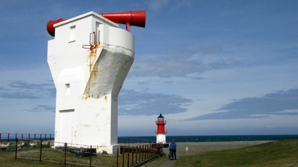
From Andreas we now followed NCN5 our onto the northern flatlands, bound eventually for the Point of Ayre, the island's northern tip. First though we wanted to detour out to the coastal strip at The Ayres, a shingly beach Iand home to the Ayres Visitor Centre, part of the Manx Wildlife Trust. Our thinking had been that, being a Visitor Centre, it might well have facilities, but we were sadly disappointed – not a café in sight. Still, by now the sun was breaking through (it was still cold) and so we stopped to study the beach and watch as the gannets dive-bombed into the waves looking for fish. It was a mesmerising sight. We followed the little track back to the road and continued to Bride where,as luck would have it, we spied a tearooms and decided they MUST be able to do us something to eat. They could and they did and we felt so much better for it. Helen smiled again.
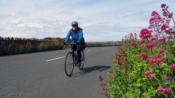
From Bride we now turned onto the cul-de-sac road out to Point of Ayre and the splendid lighthouse there. It was all pretty deserted and, from our point of view, all the better for it. There is an air of desolation about the place which is added to by the solitude we felt. Looking north out over the Irish Sea the next stop is Scotland (we couldn't see it), and the giant foghorn on the beach gives it all a surreal air. Our ride back to Bride, the hedgerows lined with valerian now in full bloom, was straightforward enough and from there it is but a short spin into Ramsey, our destination for the day. We came in along the sprawling seafront road with yet more regency hotels facing out over Ramsey Bay to England before heading in through the docklands and over the harbour bridge into town. Tonight we were not Airbnb-ing it, having managed to book ourselves into the same B and B (the Woodside) we had stayed in 4 years previously, set up on the hill overlooking the town and bay. We even had the same room, bright and airy and it all felt very comfortable.
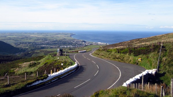
There was time still for me to indulge myself and take a spin up the TT course on the road to Guthrie's Memorial, high on Snaefell where the views are glorious, especially in the improving sunshine we were now enjoying. A few motorbikes sped by, enjoying the sweeping nature of the road with its corners and straights. For some reason Helen had declined to join me, so I took my time and played with the camera at various viewpoints before turning about and enjoying the wonderful descent back into Ramsey and a very welcome shower. That just left time for tea, tonight's dish of the day being served up in Vellikas Indian Restaurant, slipping down a treat with a pint of Kingfisher. Another good day.
Day 4: Ramsey to Douglas (37km)
Once again the weather gods were not on our side as we awoke to yet another drizzly morning, the views from our bedroom window not being what they had been the night before. Disappointing! Still, there is a bike ride to do so we have to get on with it. But first,
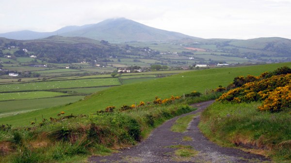
breakfast. And, for one day only, our hosts were able to serve us up a fine breakfast to start our day, a welcome change after the Airbnb experience. Suitably charged we said our farewells, repacked the bikes one last time and rode up the hill out of Ramsey. This is inevitable as heading south from Ramsey can only be done uphill. Thankfully this was not for too long, we had planned a less than direct route to Douglas as we had until early afternoon to ride the relatively short distance involved. So we opted to head east out on the A15, crossing the Manx Electric Railway for the first of several times today, and on to the little village of Maughold and the dramatic cliffs of Maughold Head, the island's eastern most point, being only 50 kilometers from St Bees Head on the Cumbrian coast. The A15 sounds major highway but really it isn't a big road. And, again, it was fairly quiet, our route rolling up and down past hedgerows and fields, the drizzle everpresent, damp tarmac underfoot. Maughold is named after the patron saint of the island who died way back in 488AD, and it is a small hamlet really, though there is a church (with a large graveyard). A rough track leads out round the churchyard and up and over the hill to Maughold Head where we headed now, reaching the road end where we were greeted by damp sheep and a murky view out along the coast. On a clear day it may have been spectacular but we shall never know!
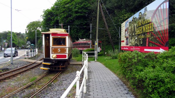
From Maughold our road now headed along south-west the coast, rolling up and down as the countryside undulated before hitting a steeper climb and crossing the Electric Railway (again) at the delightfully named village of Ballajora. We now found ourselves riding alongside the railway and, soon, we could hear a singing noise through the rails as a train caught and passed us on its way to Douglas. We carried on, heading up the side of the hills to rejoin the main A2 Ramsey to Douglas road. From here we relaxed a little and enjoyed some more relaxed cycling with less climbing. Traffic levels were still light which helped with this relaxation. One of the most striking things about Manx cycling is just how relaxed it really is compared to the UK in general where mixing it with other road users makes it so much more stressful. On the whole, along with fewer vehicles, drivers' attitudes to cyclists is much more amenable and patient (on the whole). It is, in short, a pleasurable experience.
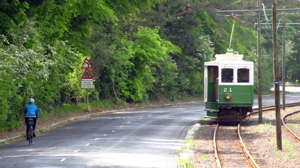
For the next few kilometers the road and railway run alongside each other, noticeably without the barriers and fencing that would be in place in the UK. It was strangely comforting. Eventually the road started to drop down into the village of Laxey, home of the world famous Great Laxey Wheel, a remnant of the mining history on the island and something we had visited on our previous visit here. Instead we felt the time was right, after nearly 2 hours on the bikes, for a café stop and we sought out Browns Café and enjoyed a welcome coffee and scone in the rather dated and surreal surroundings of this very unique establishment.
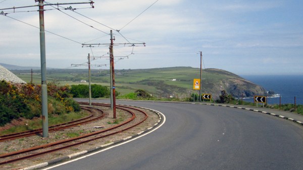
All too soon it was time to move on, we had a ferry to catch! Having descended into Laxey, clearly we now had to climb back out towards Baldrine, once again following the electric railway. At one point we had the bizarre situation where we seemed to be racing the train as we sped side by side down the hill and into Groudle Glen. The train won, but had stopped at the station there so we stopped to have a look and grab the photo opportunity. We now had one last climb, over Onchan Head, before the final descent down into Douglas and the road is dramatic, again running alongside the seemingly ever-present electric railway, and coming round the headland to reveal Douglas Bay laid out down below us. That last descent was thoroughly enjoyable, cruising gently down the hill and coming to a halt at the railway terminus which is very conveniently located right next to a pub of the same name and which had lunch written all over it!
Our journey was all but done, we had an hour or so before we needed to be boarding on our ferry so plenty of time to sit, relax and reflect on a wonderfully enjoyable four days. Compared to our 2013 trip this had been a more relaxed touring ride, with time to explore and savour the island properly. I'm sure there is still much we haven't seen but that just leaves us scope for yet another visit. Until next time then.